HOUSTON OHV TRAIL PROJECT
Learn about the OHV trail project here. We encourage everyone to take the time to learn and understand the project in its entirety.
THE HISTORY BEHIND THE OHV PROJECT
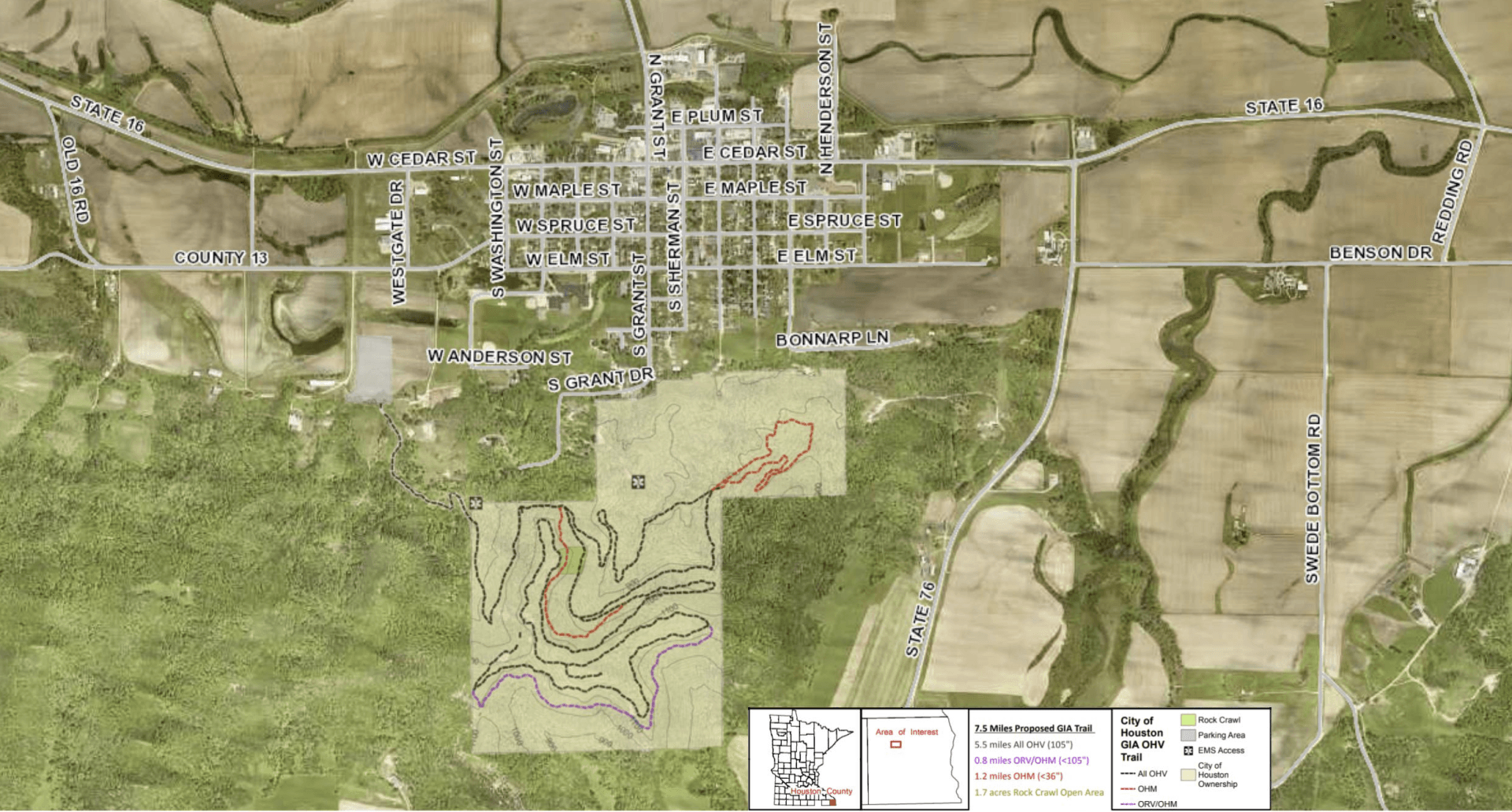
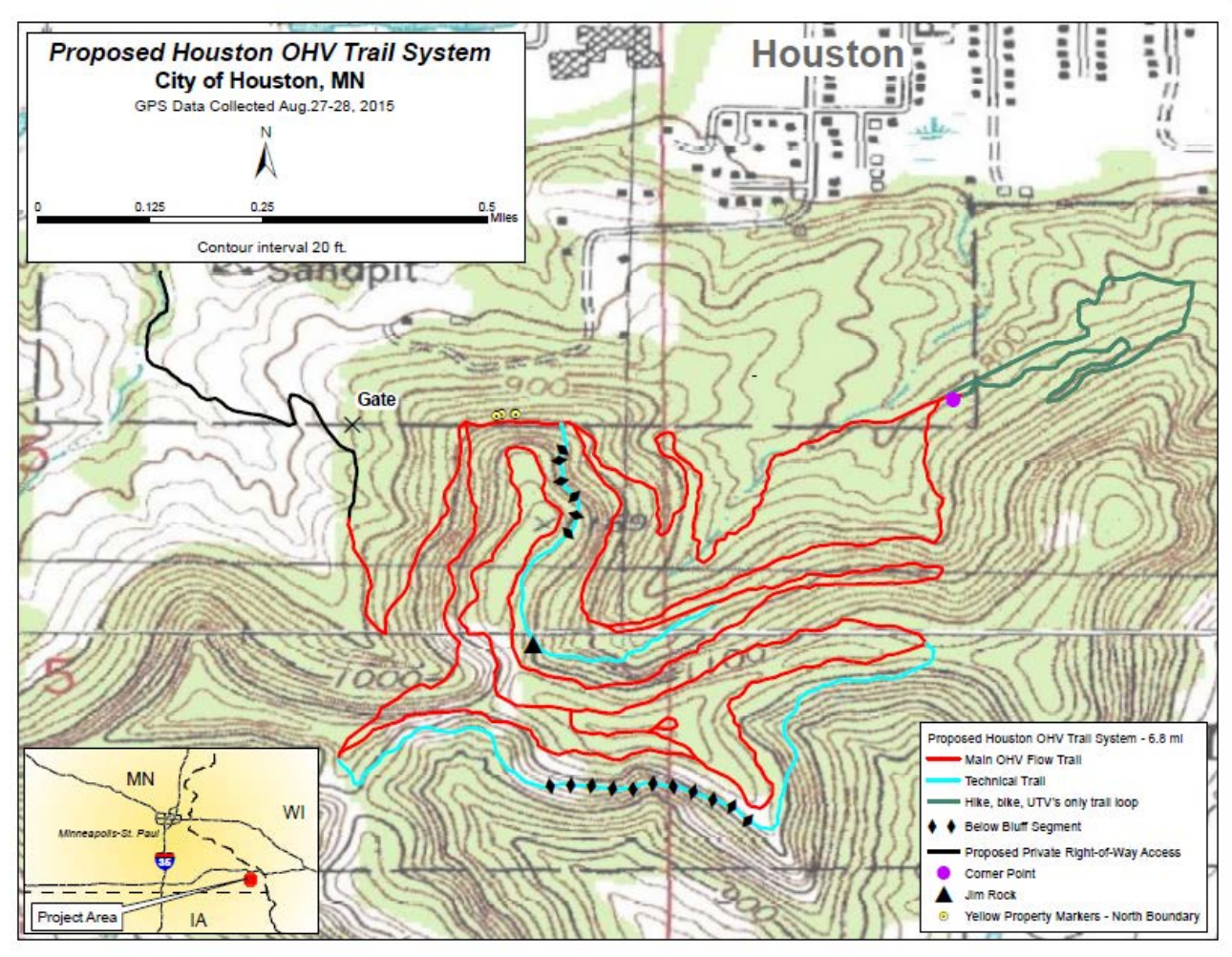
This proposal would establish 7.5 miles of Grant in Aid, off road vehicle, all terrain vehicle, and off highway motorcycle trail immediately South of the City of Houston, and within city limits. Parking will be off County Road 13. An access easement has been purchased from this parking lot to access the city land and proposed trail system. Two additional points for emergency medical service (EMS) access have been identified, with EMS access off city streets.
ALL-TERRAIN VEHICLES (ATV)

Four-wheelers, Sport, Utility, and Quads
4-WHEEL DRIVE VEHICLES

Jeeps, Trucks, Rock Climbers, and Raptors
UTILITY TERRAIN VEHICLES (UTV)

Recreational Off-Highway (ROH) and Side-by-Sides (SxS)
OFF HIGHWAY MOTORCYCLES
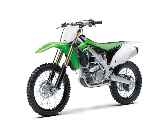
Dirt bikes, Motocross, Trail Riders, and Dual-Sport
SPONSOR
City of Houston
PROPOSED BY:
City of Houston
Rochester Rough Riders
Golden Eagles Cycle Club
North Metro ATV Club
South Metro ATV Club
Twin Cities Trail Riders
All Terrain Vehicle Association of MN
Amateur Riders Motorcycle Ass.
MN 4-Wheel Drive Association
Jeff Klein, Trail Administrator
Milo Bjerke, Trail Administrator
Tom Steiger, Trail Administraton
PROJECT LOCATION:
Houston County
Houston T103N, R06W, Sections 4&5
PROJECT DIMENSIONS:
Total of all trail segments: 7.5 miles
7.5 miles new trail through City of Houston and privately owned land with existing trail easement
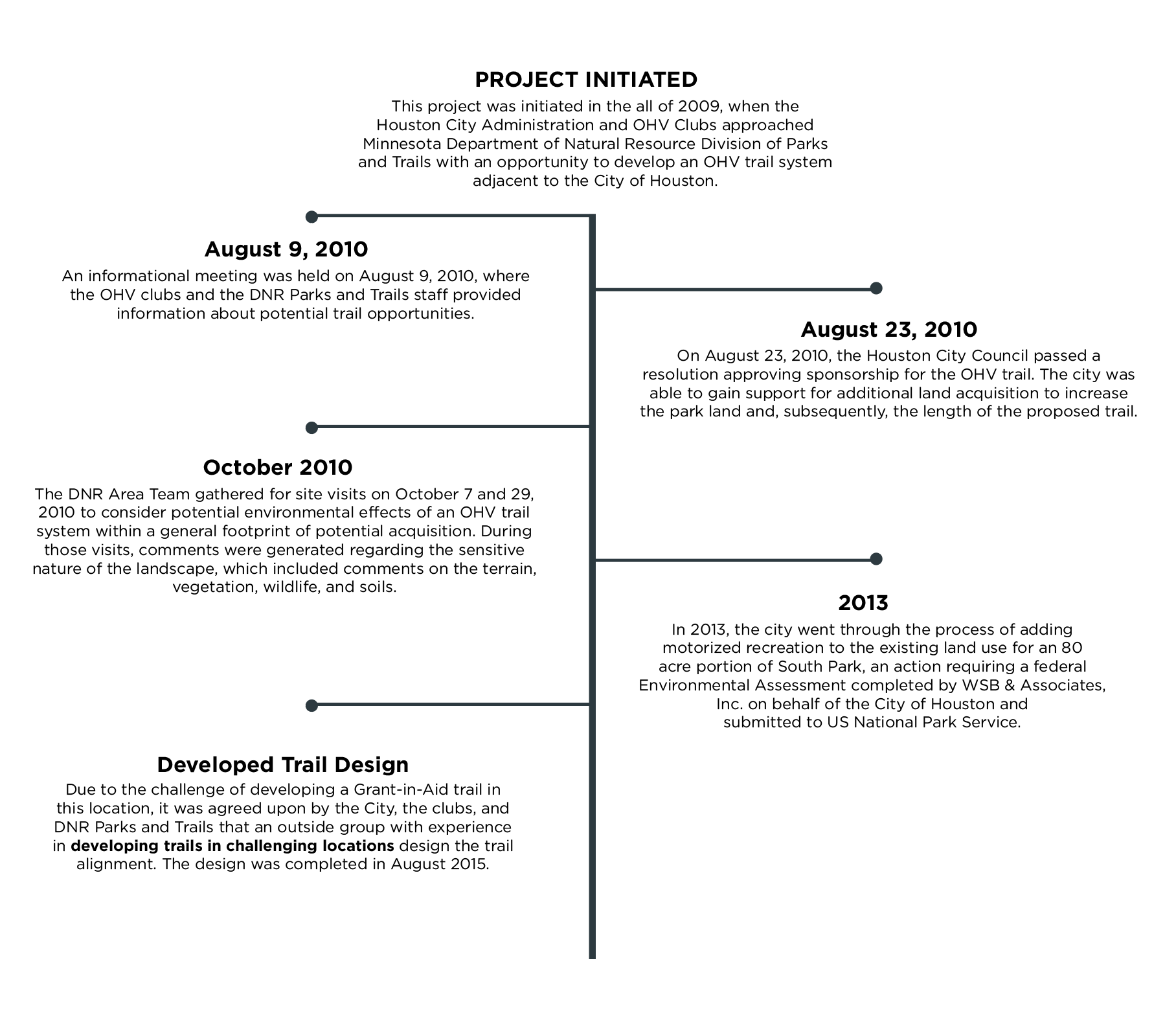
This project was initiated in the fall of 2009, when the Houston city administration and OHV clubs approached Minnesota Department of Natural Resource Division of Parks and Trails with an opportunity to develop an OHV trail system adjacent to the City of Houston. An informational meeting was held on August 9, 2010. On August 23, 2010 the Houston City Council passed a resolution approving sponsorship for the OHV trail. The city was able to get funding for additional land acquisition to increase the park land and, subsequently, the length of the proposed trail. In the following years, the city was able to add 120 acres to existing city owned park land.
THE TRAIL DESIGN
The proposed trail was designed by Trails Unlimited, LLC. Trails Unlimited was a branch of the USDA Forest Service which specialized in OHV trail system design, ground layout, and construction. Trails Unlimited, LLC. had designed OHV trails throughout the United States on public lands where they were considered experts on designing trails that are enjoyable for different groups while also taking into account various environmental concerns (sensitive soils, terrain, federally endangered and threatened species, and others).
DESIGNED BY:
US Forest Service Trails Unlimited Enterprise Unit
SUBMITTED:
October 25, 2015
Revised: March 31, 2016
FIELD TRAIL LAYOUT WORK:
Jerry Barrow
Wes Sturdevant
TOPICS OF DISCUSSION DURING FIELD WORK:
- Soil types and erosion potential
- Trail grades for sustainability
- Development of technical trails for challenge OHV users
- Wildlife concerns
- Potential noise generated by the OHV trail vehicles as a concern for the Houston citizens living near trails
- Long term maintenance requirements
- Trail management issues.
PROJECT CONCERNS TO NOTE
EVIDENCE OF SAND SOILS & SILTY CLAY
"..the Natural Resource Conservation Service soil report for the general area and the actual field observed soils supported the evidence of predominate
sandy soils and
silty clay loams soils throughout
much of the OHV project tract.
These are weak soils for frequent vehicle traffic..."
Page 12
WET WEATHER MANAGEMENT ISSUE
"..average annual rainfall is 30 to 38 inches and the average annual snowfall is 34 inches...Wet weather management will be an issue."
Page 12
CONSTURCTION COSTS
"Construction cost will be substantially higher due to rock encountered and the terrain steepness. As on all the proposed Houston OHV trail routes, selection of the appropriate construction equipment is important to minimize over-building the trail by moving too much soil."
Page 14
DIFFICULT NOISE MANAGEMENT
"...restrict noise levels to 65/60 dBA (L10/L50) during the daytime and 55/50 dBA during the nighttime. This is a low level and might be difficult for OHV machines to achieve at the City of Houston doorsteps."
Page 17
SUCCESS INVOLVES LANDOWNERS
"... recommendation for the success of the proposed Houston OHV trail system involves the City and OHV groups working very closely and involving the adjacent landowners in some decision making...", "...issues will need to be somewhat resolved before construction can begin in the future."
Page 17
DILIGENT MAINTENANCE REQUIRED
"The trail system shall require diligent maintenance and management in the mountain setting and on the susceptible soils for heavy OHV traffic."
Page 25
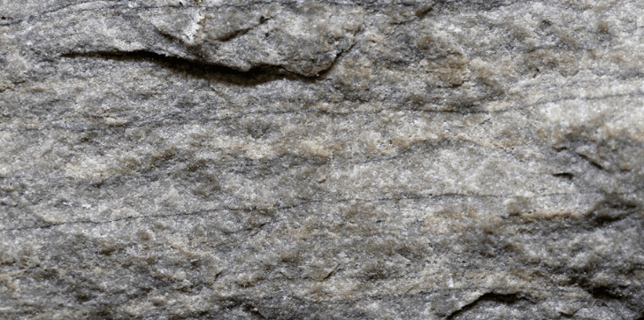
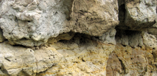
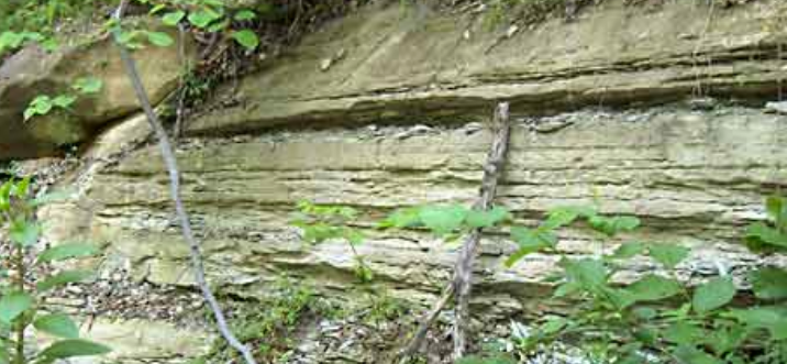
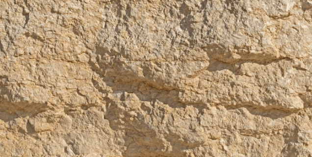
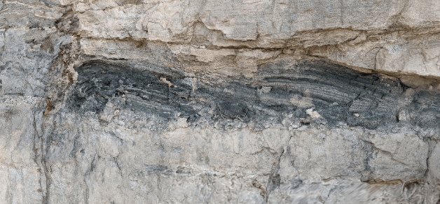
GEOLOGICAL TERRAIN
The Project site is located on hilly, bluff terrain. Much of the upland area in general vicinity is bedrock, made up of distinct layers that include, from top to bottom:
DOLOSTONE & DOLOMITIC
Issue: Sinkholes
"The cap that makes up the top of the ridge is dolostone and dolomitic sandstone of the Prairie du Chien group. This rock unit is resistant and has
documented sinkholes in the regional area including one approximately one mile west of the site. "
JORDAN SANDSTONE
Issue: Erosion
"The Jordan Sandstone unit is very soft quartz sandstone and is exposed mostly in near-vertical bluffs. Where it is not vertical it is easily eroded."
SANDY SILTSTONE & DOLOSTONE
Issue: None Noted
"This rock unit is more resistant than the Jordan, especially at the bottom of the unit. These rocks do not form cliffs like the Jordan but are not thick enough to form a flat bench."
GREY, GREEN, & YELLOW SANDSTONE
Issue: Erosion
"The Lone Rock Formation is composed of gray, green, and yellow sandstone and shale that is approximately 130 feet thick. The top 10 and bottom 30 feet may also have pink to orange dolostone in places. This rock unit forms the lower part of the slope and appears to be draped with a skirt of eroded rock material (sand, gravel, cobbles, and boulders) from the rock units above. These rocks are often highly erodible where exposed."
WONEWOC SANDSTONE
Issue: Erosion
"The bottom-most exposed rock unit at the site is the Wonewoc Sandstone. This is a soft white to tan quartz sandstone that is exposed at the toe of the bluff and is locally mined. It is highly erodible where it is exposed, although there are apparently few exposures on this site."
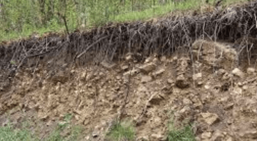
SAND, GRAVEL, CLAY & COLLUVIUM
Issue: Erosion
"The bottom slope is composed of unconsolidated sand, gravel, clay, and organics as colluvium eroded from the uplands and alluvium from the nearby streams. This sediment is highly erodible."
THREATENED SPECIES
Threatened species documented on this site:
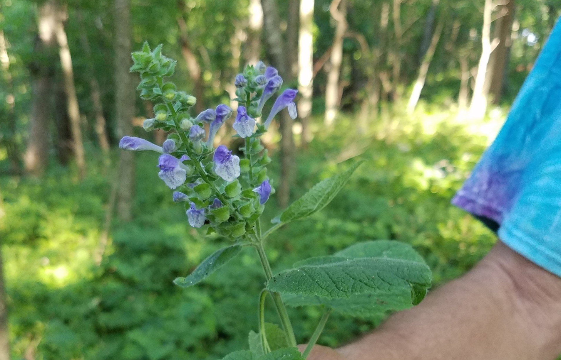
OVATE-LEAVED SKULLCAP
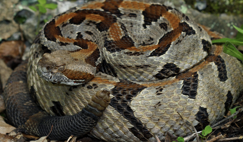
TIMBER RATTLESNAKE
(key territory identified)
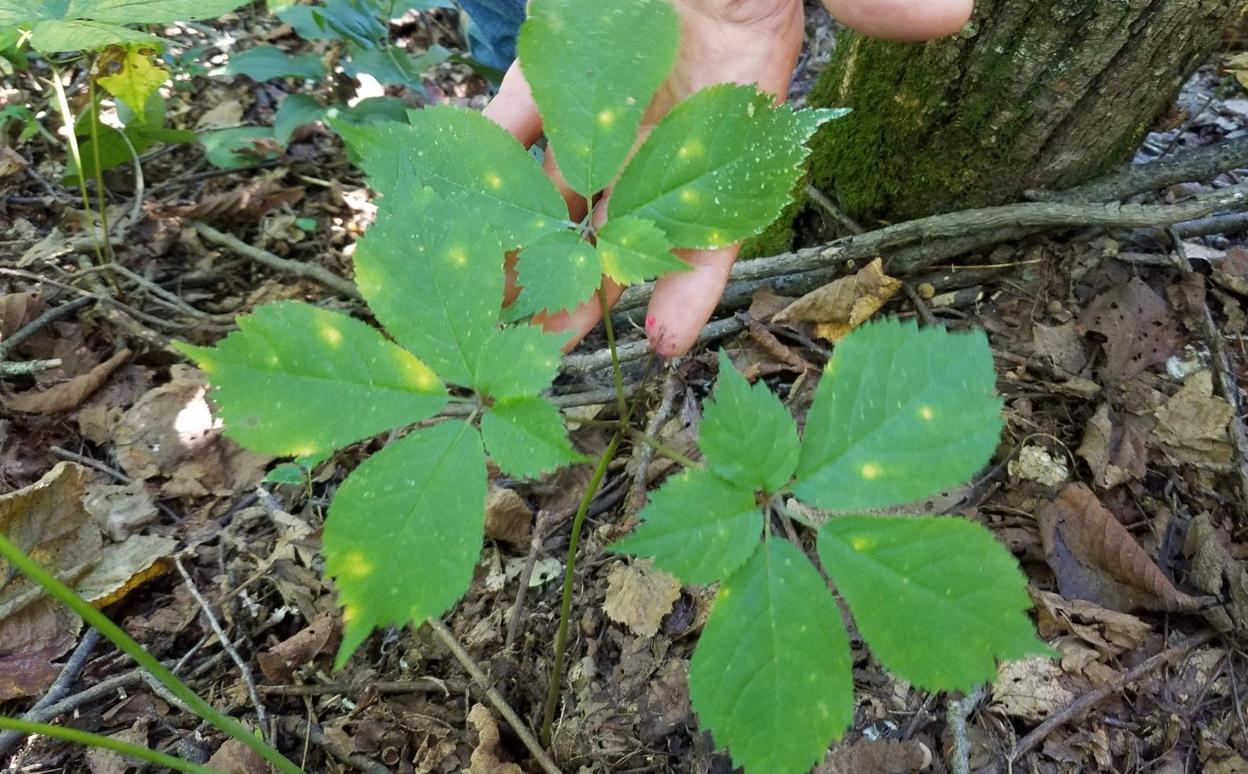
AMERICAN GINSENG
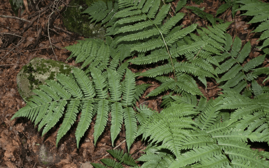
GOLDIE'S FERN
PURPLE CLIFF BRAKE
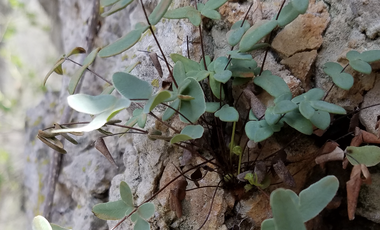
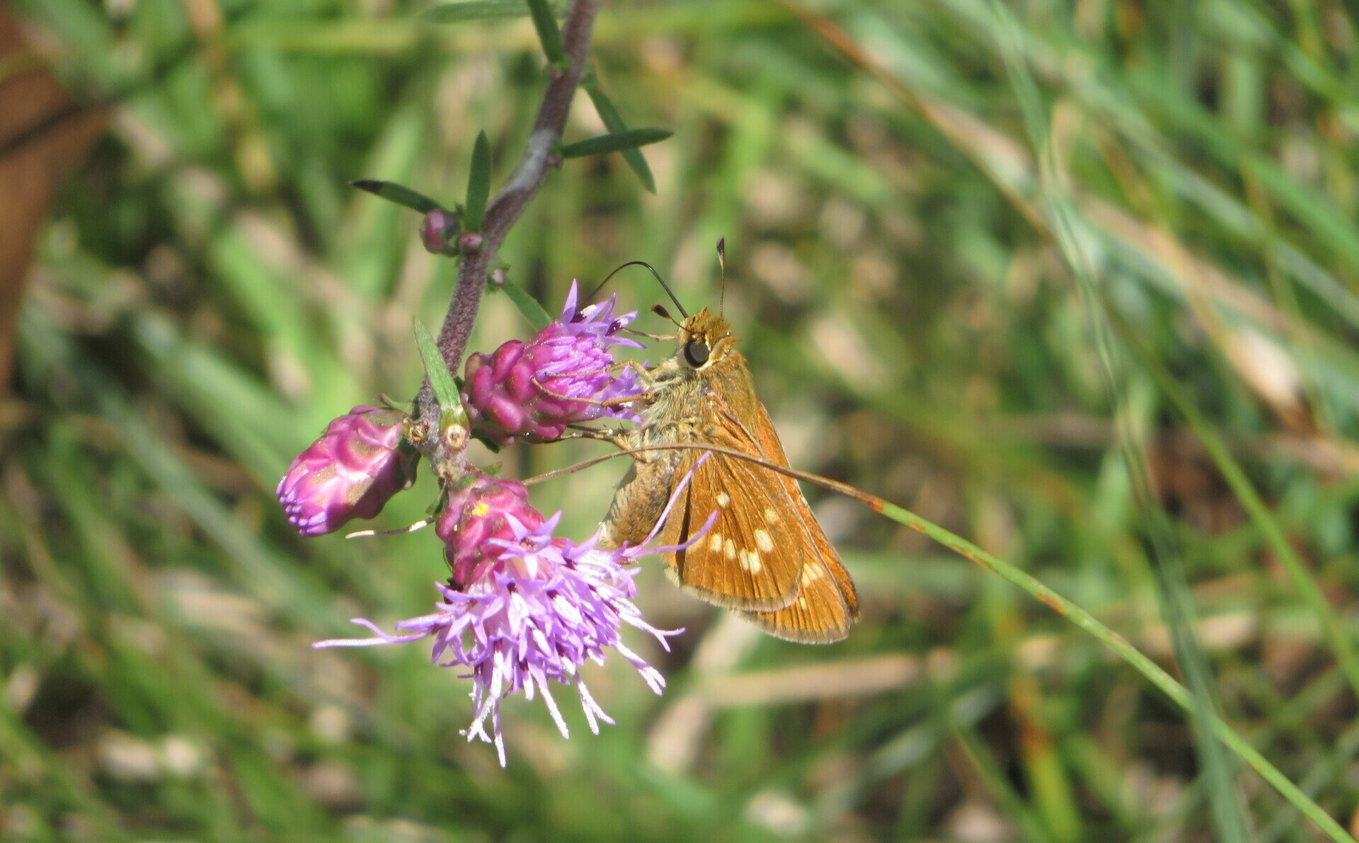
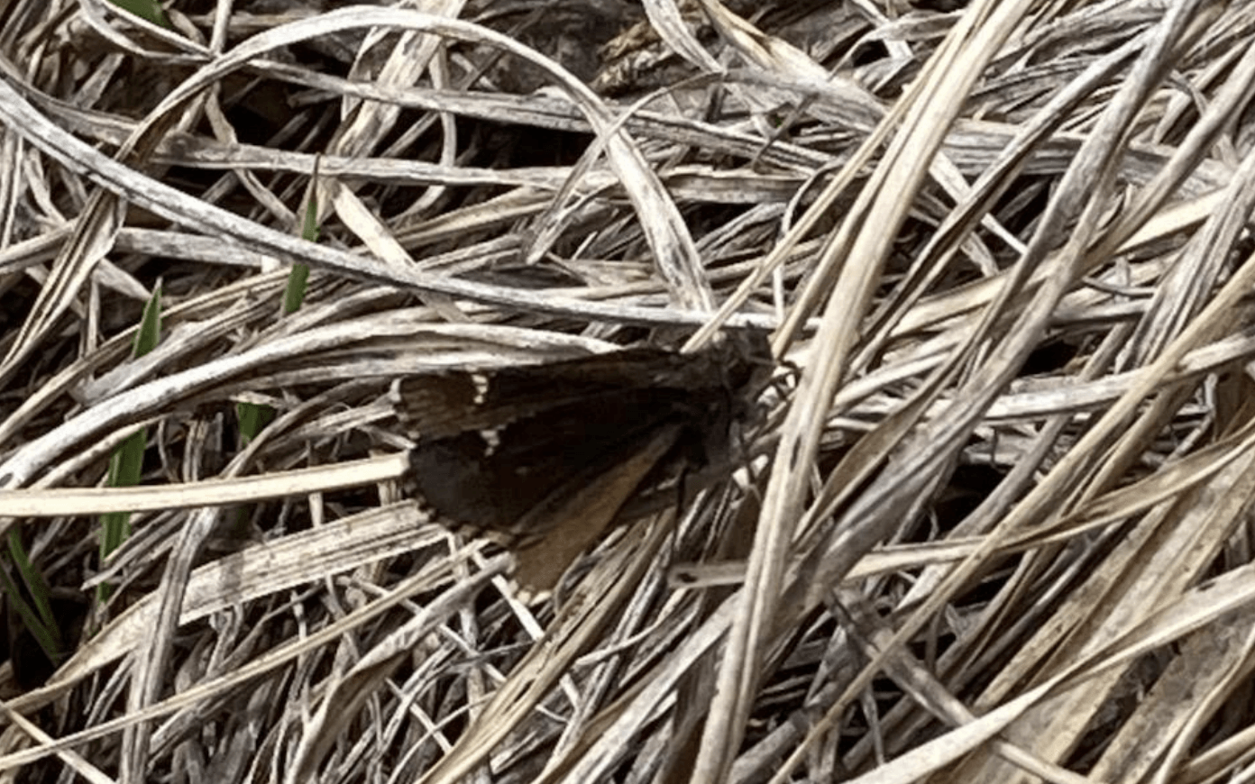
LEONARD'S SKIPPER
KENTUCKY COFFEETREE
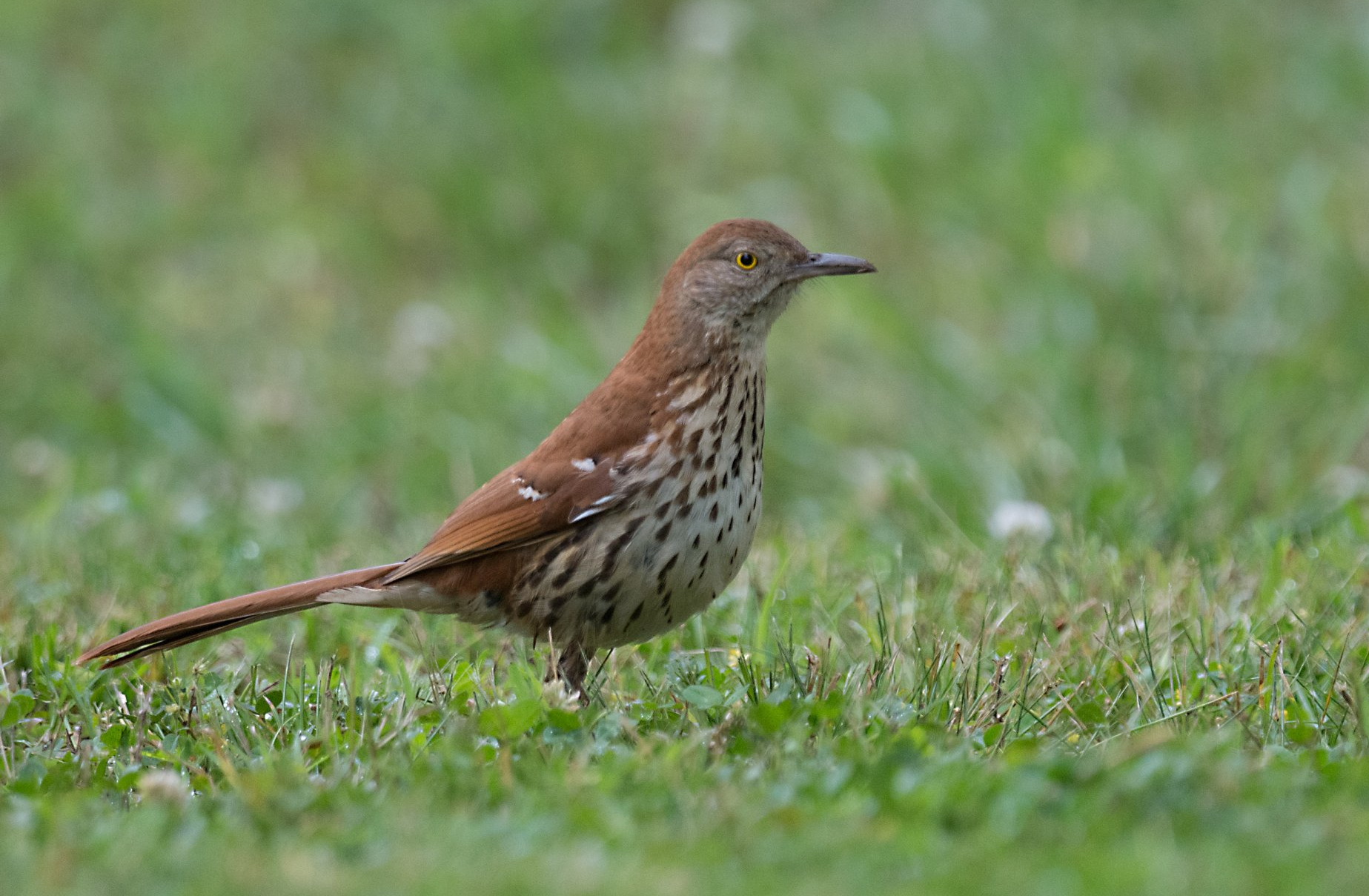
SPECIES OF GREATEST CONSERVATION NEED:
BROWN THRASHER
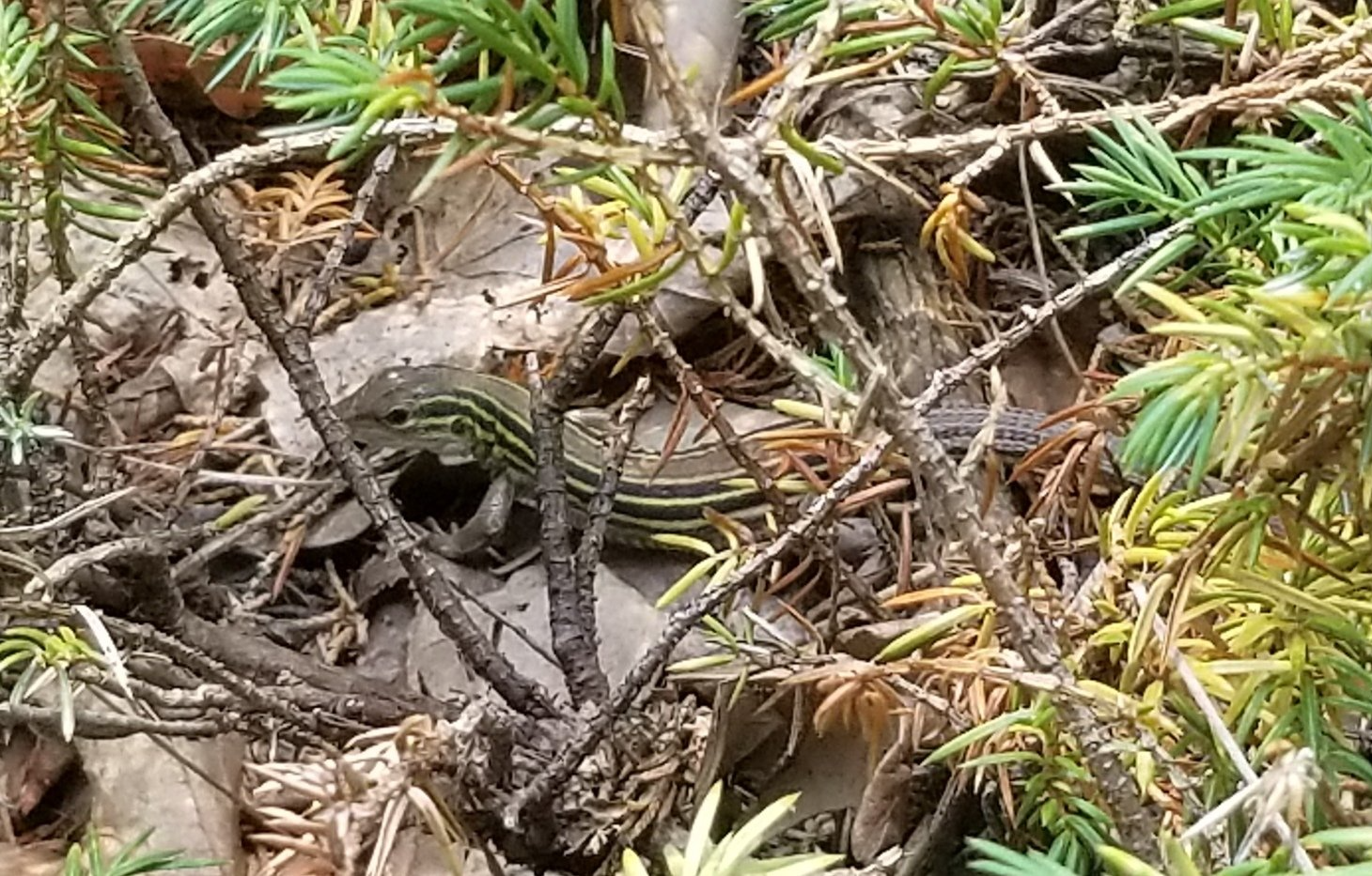
SIX-LINED RACERUNNER
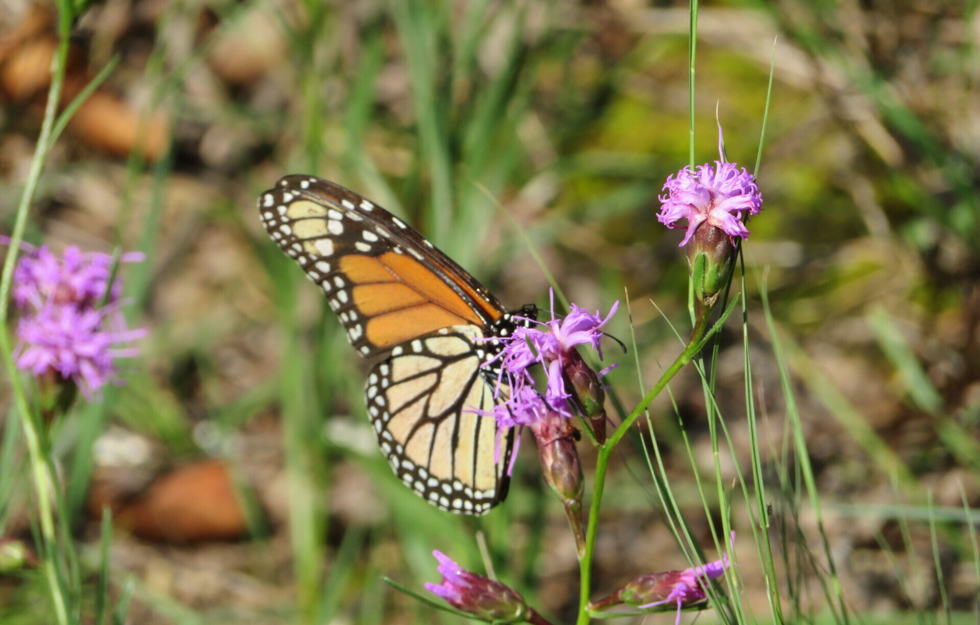
MONARCH
DUSTED SKIPPER
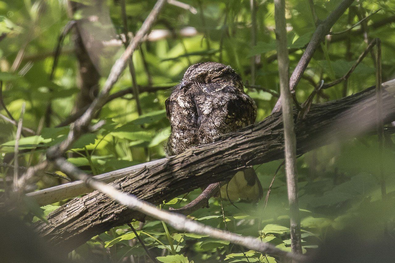
EASTERN WHIP-POR-WILL
WOOD THRUSH

EASTERN TOWHEE

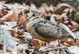
AMERICAN WOODCOCK
HISTORICAL STRUCTURE OF CONCERN:
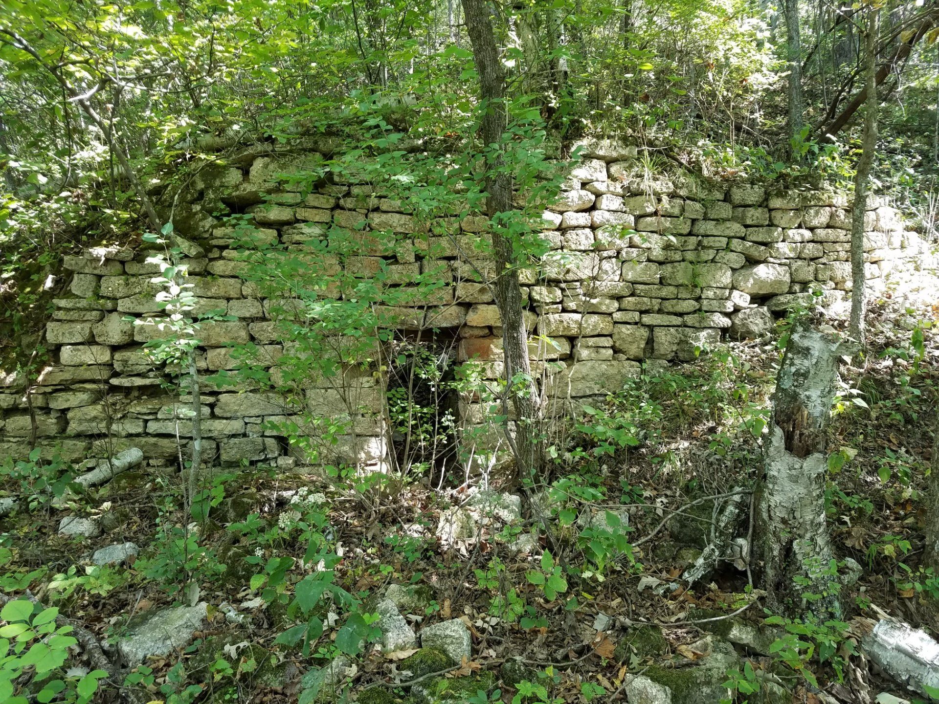
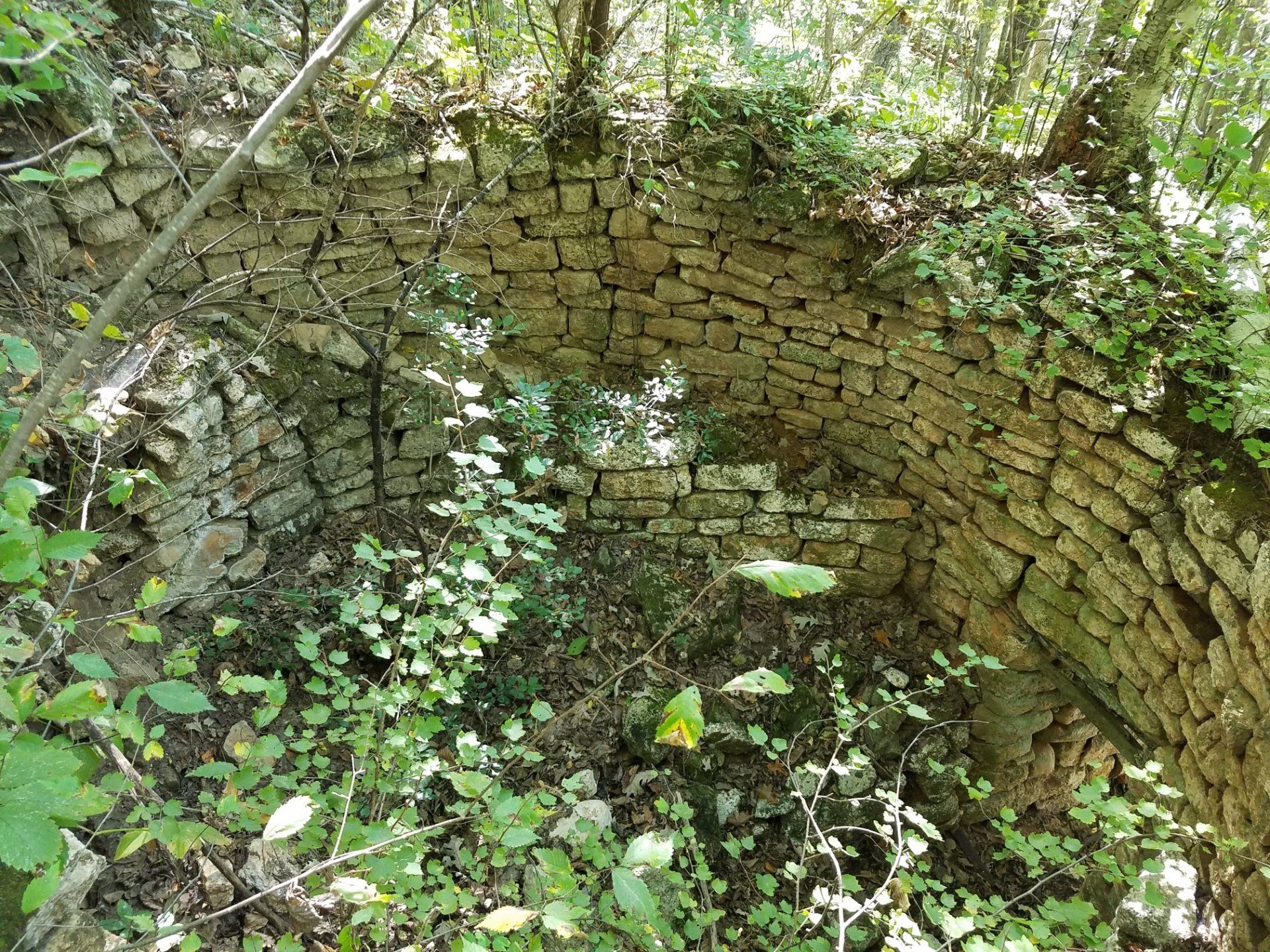
This old lime kiln, likely from the 1880s, is built into the steep hillside, very close to one of the proposed trails. It will be highly susceptible to erosion and vandalism, as it is made entirely of dry stacked stones.